Projects
A selection of my geospatial projects. Click any card to see the full write-up.
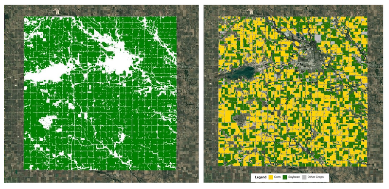
Google AlphaEarth Embeddings (AEF) Tutorials
A set of 5 tutorials developed in collaboration with the Google DeepMind team for the official launch of Google's Satellite Embedding dataset on Google Earth Engine. The tutorials cover the full spectrum of downstream tasks — from unsupervised clustering to similarity search.
AEF Embeddings Google Earth Engine
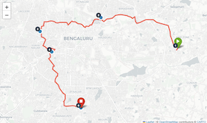
Route Optimization using OpenRouteService
This was a personal project to explore the OpenRouteService (ORS) Optimization API to find the optimal route between a set of locations. It uses GeoPy to geocode addresses and then uses the ORS APIs to find the driving route that covers all the locations in the optimal order.
Python OpenRouteService API Folium GeoPy
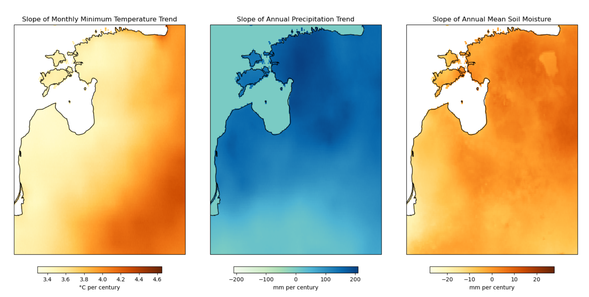
Climate Trends for the Baltics
Analysis of long-term climate trends across Estonia, Latvia, and Lithuania using the TerraClimate dataset (1958–2023). Quantifies multi-decadal trends in temperature, precipitation, evapotranspiration, and soil moisture, with spatial trend maps.
Python XArray TerraClimate Dask rioxarray